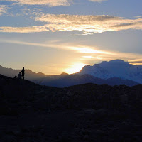
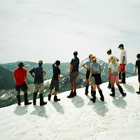
Backpacking

Lost Coast

5 minutes to read — 1014 words

Lost Coast
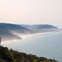
State Route 1 runs along the Pacific Coast for most of California’s length, winding steeply and sharply along some of the world’s most spectacular shores. But about forty miles north of Mendocino, the highway takes an abrupt turn east and joins Highway 101 further inland. The highway leaves the coast because that part of California is so rugged that the highway’s planners simply couldn’t build a road there. Known as the Lost Coast, the area boasts some of the most incredible coastline in the world, with steep cliffs and hills dropping straight into the ocean.

Carson Iceberg Wilderness

5 minutes to read — 943 words

Carson Iceberg Wilderness
About thirty miles south of Lake Tahoe and thirty miles north of Yosemite, the Carson Iceberg Wilderness is a little known gem in California’s high country. Just beyond Bear Valley on Highway 4, the wilderness is past the point at which the road is maintained in winter, making access impossible after the first heavy snows of winter. I led an introductory backpacking trip to Carson Iceberg just before the beginning of the winter season.

Arroyo Seco Canyoneering

4 minutes to read — 770 words

Arroyo Seco Canyoneering
Every quarter, the instructors of the Stanford Outdoor Education Program (OEP) go on a retreat to refine skills and plan trips and lessons. For our Spring 2008 retreat, we took advantage of a spell of hot weather to brave the cold, swift waters of Arroyo Seco, a gorgeous canyon east of Big Sur. Not only is Arroyo Seco beautiful, but it’s much closer to campus than the Sierras, so it made for a short and easy drive.

Trinity Alps

3 minutes to read — 554 words

Trinity Alps
Tucked in the northwest corner of California, the Trinity Alps are a small but spectacular mountain range. The Trinities have been on my list of places to visit for a few years now, so I was excited for an opportunity to explore them. I joined a group planning to snowshoe up the Canyon Creek Trail to the Canyon Creek Lakes, an eight mile hike with 3,500 feet of elevation gain. The goal was to get as far as possible up the trail, given the storm forecast for the weekend.

Point Reyes

3 minutes to read — 621 words

Point Reyes
During our week off from school for Thanksgiving, my friend Paul and I decided to do a short backpacking trip along California’s Point Reyes National Seashore. We left early on Monday morning, piling ourselves and our gear into Paul’s 1978 Volkswagen bus. The morning was cloudy and gray, with dreary rain tumbling from the overcast sky. We drove for a little over two hours, picked up a permit, and parked at the trailhead.

Wrangell Mountains Part Two

9 minutes to read — 1705 words

Wrangell Mountains Part Two
After the first two weeks of my trip to Alaska in the summer of 2007 (see Wrangell Mountains Part One for stories from those two weeks), I began designing my field study for the second segment of the program. Along with a group of three other students, I decided to study the issues involved in safe bear-human coexistence, including identifying bear habitat to help backcountry travelers avoid or at least be conscious of it, and researching methods for storing bear attractants in the backcountry.

Wrangell Mountains Part One

5 minutes to read — 1045 words

Wrangell Mountains Part One
If you follow the archipelago of southeastern Alaska north to the Gulf, the first mountain range after the coast is the Chugach. Stay on the far eastern edge of Alaska and continue north forty miles. There lie the Wrangell Mountains, a stretch of peaks forged by ice and fire, carved by glaciers, forced upward by the crashing of tectonic plates, and scorched by volcanoes. In 1980, Wrangell – St. Elias National Park and Preserve was created.

Emigrant Wilderness

5 minutes to read — 933 words

Emigrant Wilderness
The final trip of my Advanced Wilderness Skills class this quarter was a student-led backpacking trip to the Emigrant Wilderness. I’d never visited the Emigrant Wilderness, but it was described to me as a larger, less-crowded Desolation Wilderness. I knew the Desolation Wilderness to be a gorgeous area, so I was excited to explore Emigrant. We left campus at around 7:00 PM on the evening of Friday June 1. The drive along Highway 108 was long.

Dewey Point Snowshoe

11 minutes to read — 2223 words

Dewey Point Snowshoe
I gunned the Highlander down Miner Road and smiled to myself as I noticed that the stoplight at the intersection with Camino Pablo was already green. A few minutes later I turned into the Orinda Safeway. As the three rucksacks in the back of the car testified, I was on my way to go backpacking with two of my best friends. Kayleigh and Kelsey on the trail We strode boldly into the grocery store and began to select the food that would sustain us for the next few days.

The Bitterroot Mountains

6 minutes to read — 1249 words

The Bitterroot Mountains
Straddling the Montana-Idaho border, the Bitterroots are a remote but spectacularly beautiful mountain range in the Northern Rockies. It was among these rugged peaks that Lewis and Clark crossed the Continental Divide in the early nineteenth century. The summer after my sophomore year in high school, I spent a month in Wyoming, Idaho, and Montana on a wilderness leadership training program. The trip included an unforgettable nine day, sixty-five mile backpacking trip across the Bitterroots, much of which would turn out to be off the trail.