
Pyramid Peak
california mountaineering winter snowshoeing

At 9,983′, Pyramid Peak is the highest point in California’s Desolation Wilderness. Since it is only about a three hour drive from the San Francisco Bay Area, Desolation Wilderness is the most heavily-used wilderness area in the United States. Thus exploring Desolation during the winter months has a number of advantages—not only do the snow-covered peaks make for spectacular vistas, but most of the visitors that swarm the area during the summer are kept away by colder temperatures and feet of snow.
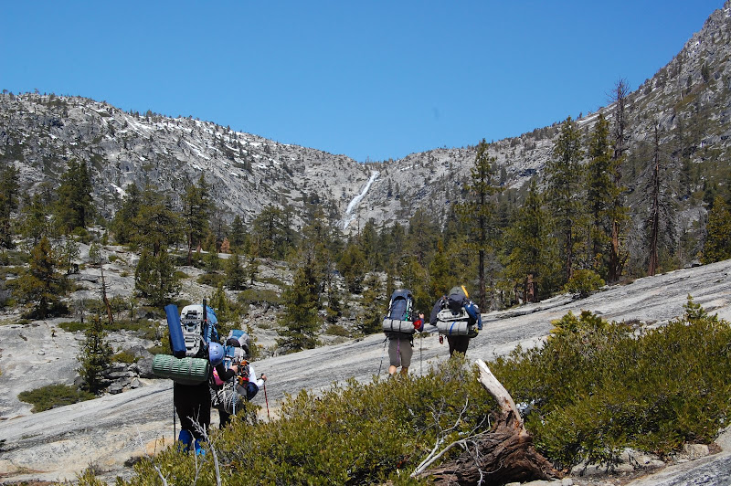
I led a trip to climb Pyramid Peak during late April for the Outdoor Education Program. Pyramid Peak is usually approached directly from Highway 50 during the winter. The most common summer route starts from Echo Lakes, but that trail head was still snowed in for our trip. There are two approaches: over Rocky Canyon or over Horsetail Falls. Both are steep, but Rocky Canyon is more direct and makes a good dayhike, even in winter. The approach over Horsetail Falls is more suitable for an overnight trip.
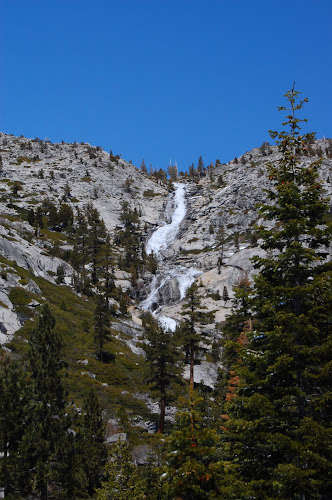
Horsetail Falls is also one of the most beautiful falls in the area. We hiked along the creek beneath it, and then ascended the slope to the west of the falls. The hike was very steep, over small- to medium-sized talus. It was a hard slog with our heavy packs, but since the falls face south there was very little snow. That changed as soon we crested the ridge above the falls. On the northern side of the falls, everything was covered with snow. We strapped on our snowshoes and started exploring the area northwest of the falls.
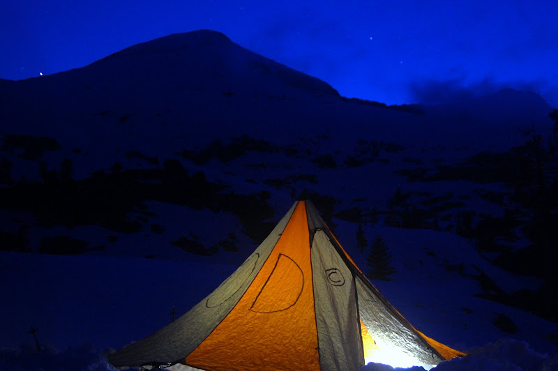
Northwest of the falls is a basin containing several alpine lakes. All the lakes were still frozen over, so navigating them was a little tricky. We ended up camping on the eastern side of Toem Lake, which lies below the eastern side of Pyramid Peak. After a delicious dinner of rice with peanut sauce, we went to bed.
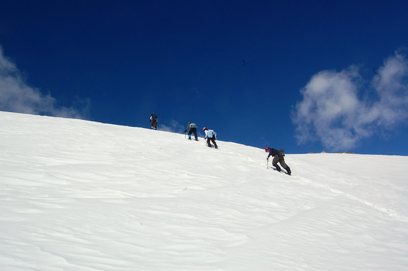
We woke up at six the next morning. On the southwestern edge of the lake, my co-instructor, Jim, and I taught a self-arrest clinic. Then we picked up our ice axes, strapped on our snowshoes, and headed for the summit. The ridge beneath the peak’s eastern face looks rather daunting, but we saw an obvious line up the bottom half of the ridge west of the lake. With our snowshoes on, we were able to walk straight up the rest of the ridge. At that point, we were below the final, pyramid-shaped part of the mountain.
We had discussed possible lines up the mountain the previous night and decided that the easiest route would be the ridge due south of the summit. However, our route up the ridge had taken us to the far north side of the eastern face. Thus accessing the south ridge would mean traversing the entire eastern face. Ascending the face directly didn’t look so bad, so we started hiking straight up it.
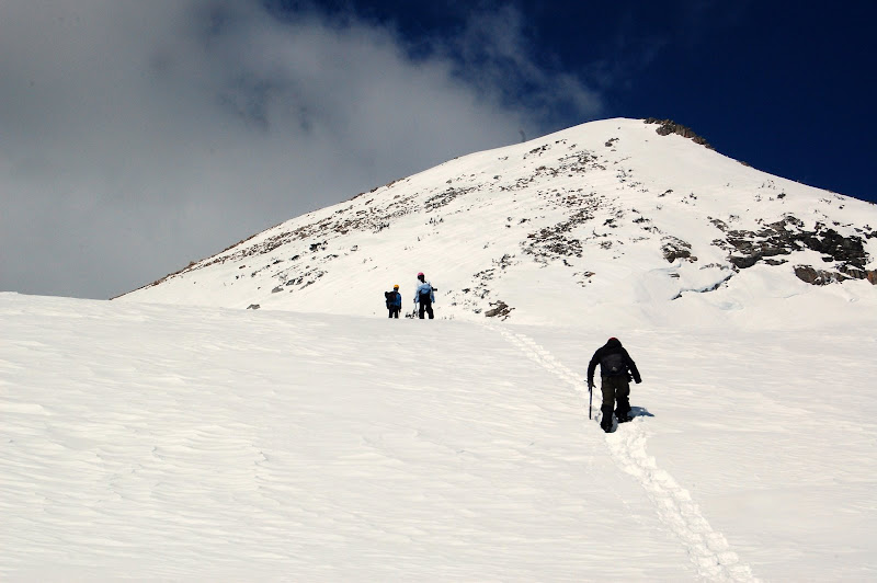
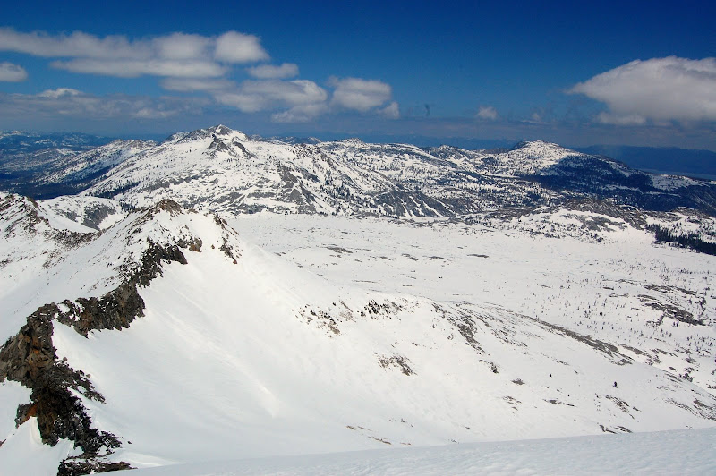
About 600 feet below the summit, the slope became too steep for snowshoes. We took them off and began kicking steps. By 12:30, the entire group was standing on the summit. We had some fantastic views of other nearby peaks, a distant corner of Lake Tahoe, and the completely frozen Aloha Lake. We spent about half an hour on the summit and then began our descent.
The descent was fun. The snow had softened enough that glissading down our steep ascent route was quick and easy. We returned to camp in the early afternoon, packed up, and returned over Horsetail Falls. We descended the talus slowly, reaching our car at about 7:15.